Our site is on BLM land and we have a Special Recreational Permit for use.
DO NOT DRIVE OFFROAD
WALK FROM THE ROAD TO RETRIEVE ROCKETS
DO NOT LITTER, NO FIREWORKS
DO NOT HASSLE CATTLE OR WILDLIFE
FAILURE TO BEHAVE PROPERLY CAN GET YOU BANNED FROM FLYING AND FUTURE EVENTS
36°30'35.1"N 107°49'27.3"W ( 36.50975, -107.82425 )
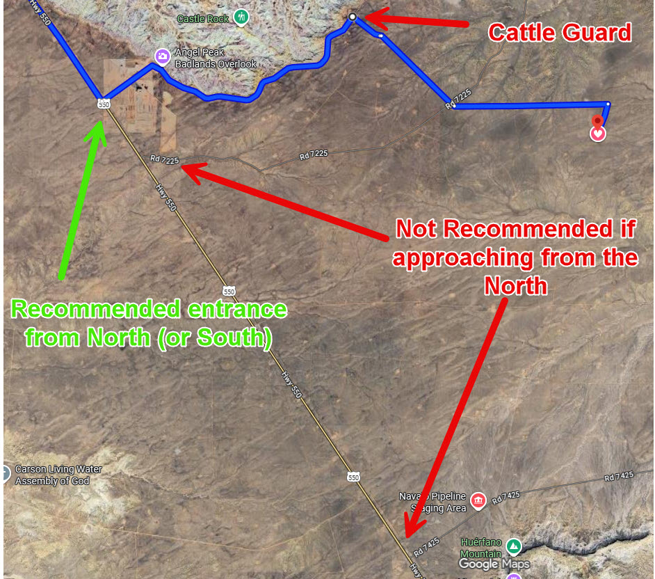
Go first to this waypoint: >> Angel Peak Turnoff <<
And then on to the launch site from there: >> Rattlesnake <<
A 4WD or other high clearance vehicle is strongly recommended.
A 2WD vehicle might get stuck in the mud (when wet) or sand (when dry).
The other two entrances have no left turn lane from the north so they can be dangerous if you approach from the north and then stopped for oncoming traffic while in the fast lane to turn left onto the dirt roads.
Approaching from the south is not as bad, but 4CRA does not evaluate those routes when checking on road status.
The Google route above should take you to an entrance to the BLM land that has a cattle guard which can be more easily crossed enroute to the site.